Whether you’re a nature lover or just seeking some high-intensity cardio, these Arizona trails deliver scenery that beats the gym any day. We’ve rounded up our 7 favorite hikes within an hour drive from Phoenix. The desert is intense, pack more water than you think you need and plenty of sun protection. Hiking etiquette is to leave no trace, use headphones not speakers, and yield to uphill hikers as they have the right of way. Permits are required for some of these hikes and are mentioned below. Don’t risk getting lost by downloading the AllTrails app and subscribing to the Plus version for access to maps offline.
Piestewa Peak Summit Trail #300

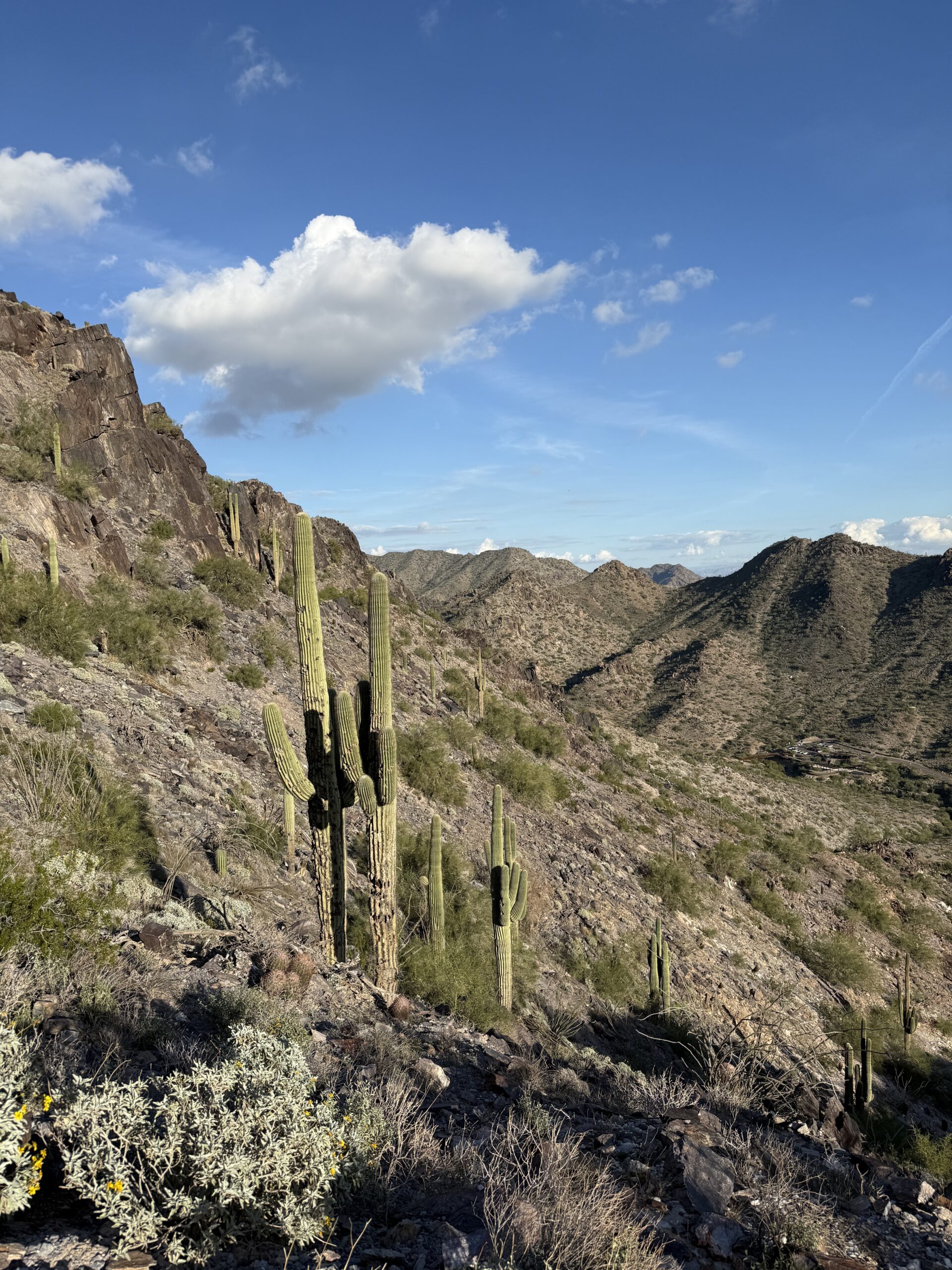
Originally named Squaw Peak, the trail has been renamed to honor US Army Soldier Lori Piestewa, the first Native American woman to die in combat while serving in the US military. Tribal leaders and activists lobbied for the former name to be changed long before her death because “Squaw Peak” was considered a derogatory term. This trail is located in the Phoenix Mountain Preserve and rated hard as it is one big stairmaster. Only a little over 2 miles out and back, but an elevation gain of 1,145 ft and a very rewarding 360 degree view of Phoenix at the summit. Pack plenty of water as there is little shade on the trail and do not attempt to hike at temps over 100 degrees. The City of Phoenix closes this trail during certain hours in the summer when temps are extreme. Dogs are not allowed on this trail yet many times we’ve seen people drag their poor pups along. Please leave your dog at home if you want to hike Piestewa.
If you’re an early riser, plan a sunrise hike and you may get lucky and find a man preparing biscuits and gravy at the summit. One of the first times I did this hike, I got to experience Ken Koshio playing Amazing Grace on a flute as the sun came up. It was magical.
- Piestewa Peak Summit Trail #300: 2.1 mi Out & Back; 1,145 ft elevation gain; 1-2hrs
Peralta Canyon Trail
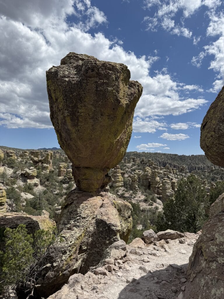
The Superstition Mountains are to the east of Phoenix, spread out across Apache Junction and Gold Canyon, and rumored to be haunted by the Lost Dutchman guarding his hidden gold mine. In the Gold Canyon area of this mountain range, our favorite hiking trail is the Peralta Canyon where you’ll get a beautiful view of Weaver’s needle. You can either hike Peralta to Fremont Saddle or a little further to Lone Tree. Pictured here is the Weaver’s Needle from Lone Tree.
- Fremont Saddle via Peralta Canyon: 4.6 mi Out & Back; 1,338 ft elevation gain, 2-3hrs.
- Lone Tree via Peralta Canyon: 5.6 mi Out & Back; 1,459 ft elevation gain; 3-4hrs.
Butcher Jones
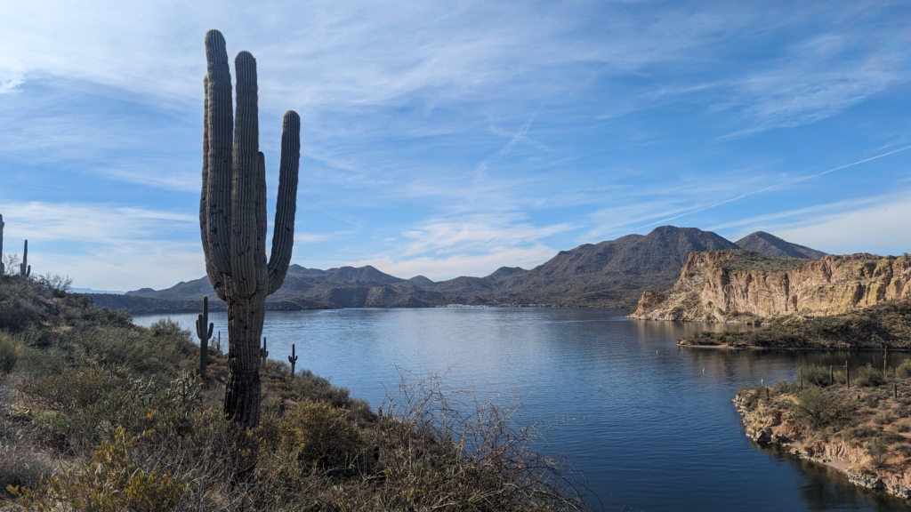
Did you know that Arizona is not all desert? Not only are there cities where all four seasons exist because of the altitude, there are also several lakes within an hour of Phoenix. Butcher Jones trail follows Saguaro Lake and offers incredible desert and lake views. Start or end your hike with a picnic at the lake or come back another day for a leisurely paddle. Permits can be purchased in the parking lot.
- Butcher Jones Trail: 5.8 mi Out & Back; 639 ft elevation gain
Camelback Mountain
Camelback mountain is Phoenix’s iconic hike with two trail options; Echo and Cholla trails, and rated hard. Please, please, please, do not attempt this hike during extreme temps and without enough water. Rescues occur frequently here because people underestimate how quickly dehydration and heat exhaustion creep up. We only hiked the Cholla trail halfway because of a time constraint, but I returned to hike Echo and parts of the trail became so narrow they seemed to disappear into the side of the mountain. The end is a rock scramble. Definitely not for those who are afraid of heights. Not sure how I managed but the summit was beautiful with a 360 degree view of the Phoenix area.
- Echo Canyon Trail: 2.6 mi Out & Back; 1,456 ft elevation gain
- Cholla Trail: 3 mi Out & Back; 1,289 ft elevation gain
Wave Cave
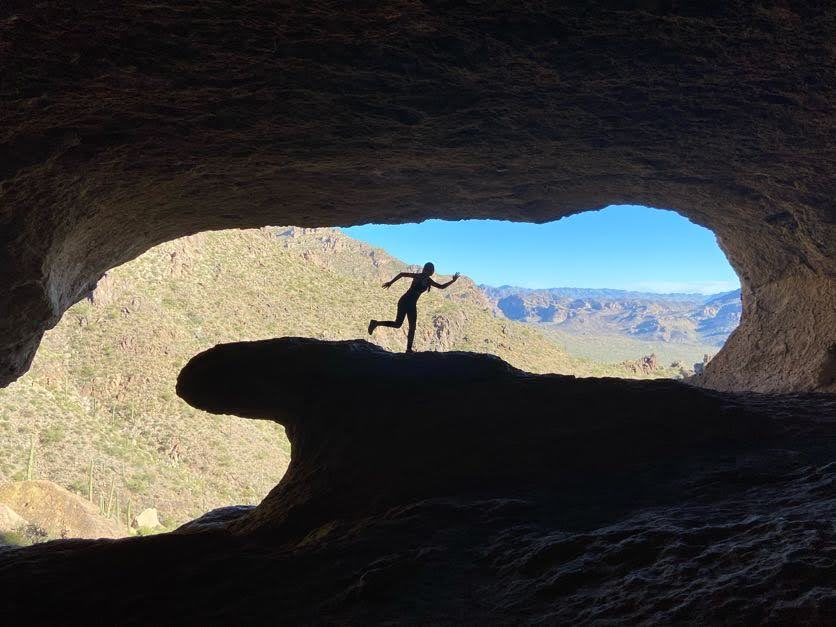
One of our first hikes after moving to Arizona was the Wave Cave in the Superstition Mountains. There’s a steep climb towards the end which makes this a moderately challenging hike but the cave allows you to rest in the shade and take in the views. As the name states, this cave looks like an ocean wave from the inside looking out. Permits are required and can be purchased online, not at the parking lot.
- Wave Cave Trail: 3 mi Out & Back; 820 ft elevation gain
Pinnacle Peak Trail
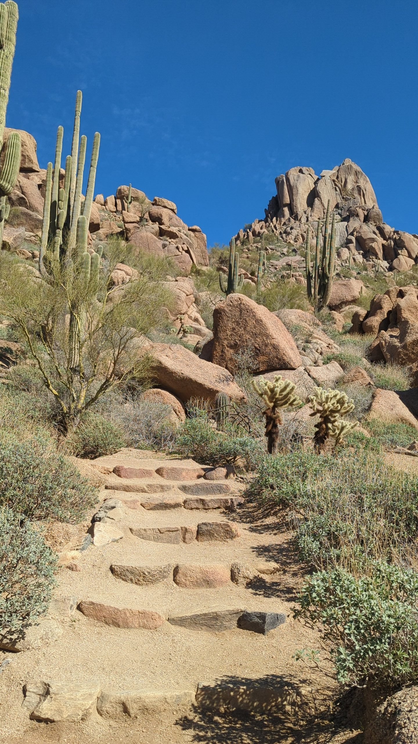
Pinnacle Peak is a beautiful well marked trail that showcases amazing views of Scottsdale. Get ready to see incredible homes below that make you wonder what people do for a living, and Instagrammable desert landscapes. The summit is only open to rock climbers with the appropriate gear. There are bathrooms at the trailhead and no permit is required. Afterwards, head to Isabella’s Kitchen for some tasty bites and enjoy the golf course views.
- Pinnacle Peak Trail: 4.1 mi Out & Back; 1,020 ft elevation gain; 2-2.5 hrs
Dobbins Lookout
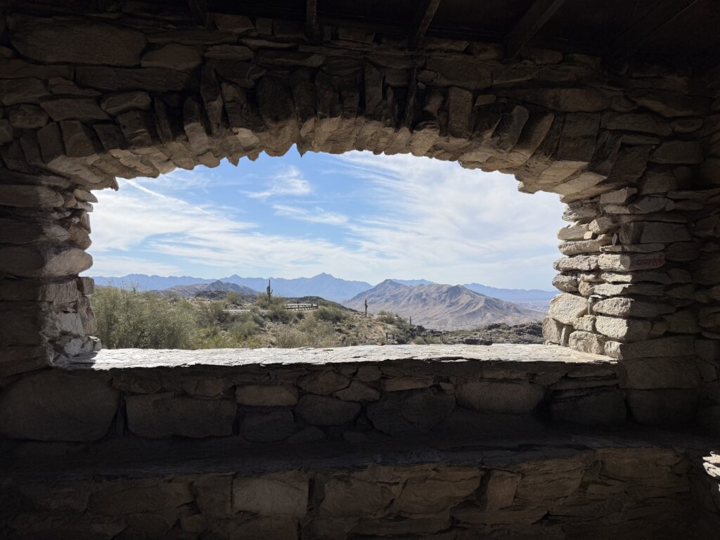
South Mountain Park is in the southern part of Phoenix and has several great trails for hiking and mountain biking. Dobbins Lookout is at the top of South Mountain and can be reached via hiking trails or by car. If you drive, be prepared for narrow windy roads. The summit provides a vast 360 degree view of Phoenix that is incredible at any time but sunrise and sunset are the most popular.
- Dobbins Lookout via East Mineral Rd: 3.8 mi Out & Back; 1,000 ft elevation gain; 2-3 hrs
- Holbert Trail to Dobbins Lookout: 4.6 mi Out & Back; 1,000 ft elevation gain; 2-3 hrs
Let us know which hiking trail is your favorite in the comments. Looking for more adventures in Arizona? Check out additional blog posts dedicated to our home state here.